Sunrise is not when the sun clears the ridge.
Most sun apps time the light against a flat sea horizon. In a valley, a canyon or a city, that answer is wrong by twenty minutes to two hours. Ridgelight reads the terrain around you — on one screen, with no suite to learn first.
iPhone. $11.99 once. No subscription, no account.
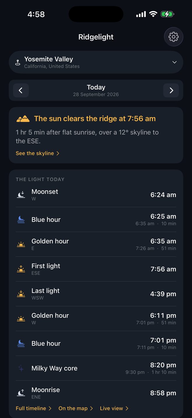
It reads the ground you are standing on.
Rays are cast out to 40 km over open elevation data, corrected for the curve of the Earth and for the way the atmosphere bends light back down. The result is the angle of the skyline in every direction, used instead of a flat horizon.
The app also draws that skyline over your camera view, so you can hold the phone up and check our terrain against the real ridge in front of you.
First light and last light
- The moment the sun clears the skyline, and the moment it drops behind it
- How much later that is than the flat sunrise every other app shows you
- The angle of the ridge doing the blocking, and where it sits
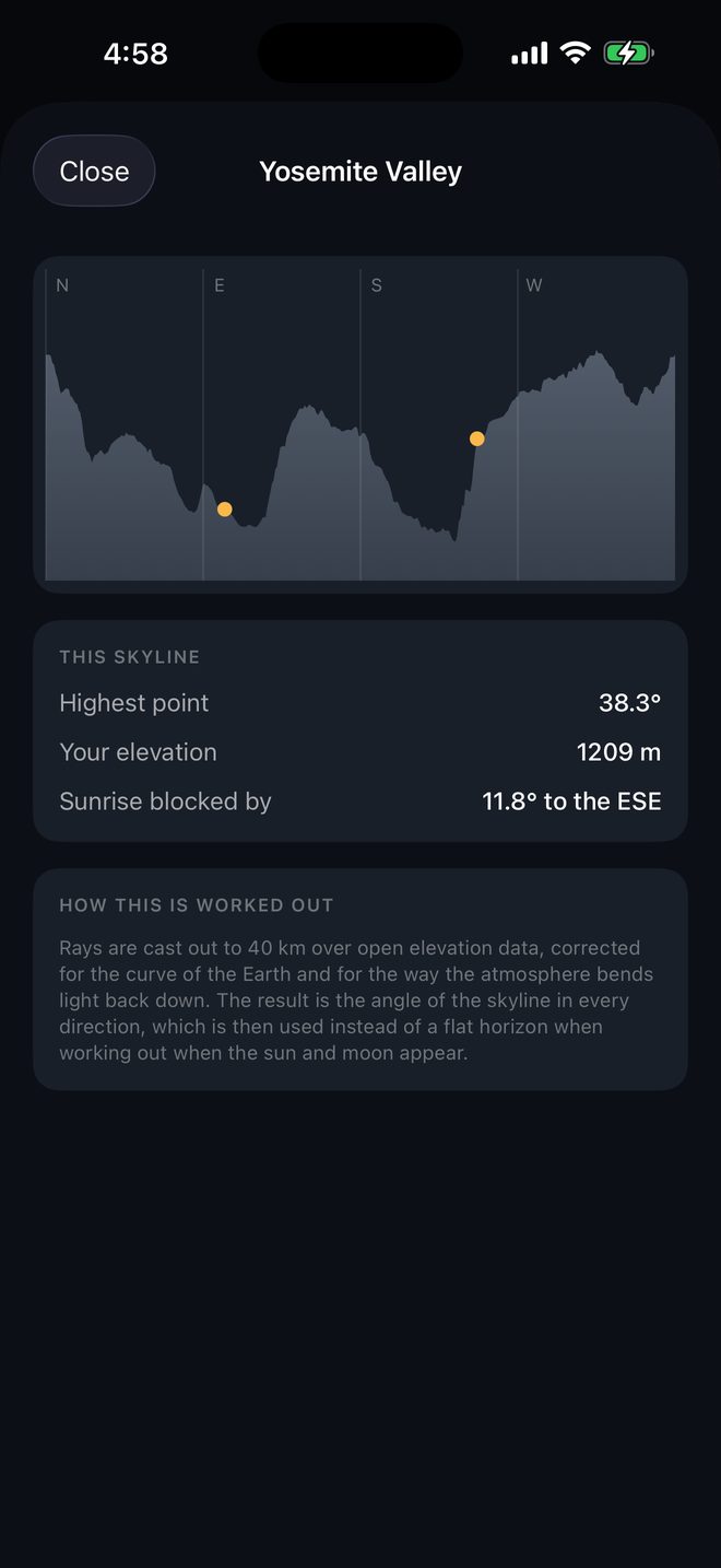
The light, in order
- Golden hour and blue hour as windows, not single times
- Civil, nautical and astronomical twilight
- Moonrise, moonset and phase, also over the real skyline
- The Milky Way core: when it is up, high enough, and the sky is dark
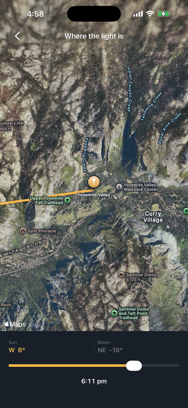
The rest of it
Search by landmark
Half Dome, not 37.7459, -119.5332. Save the places you shoot and scrub to any future date.
Live view
Hold the phone up and see where the sun and moon go. Compass off? Tap the sun where you actually see it and the correction sticks.
Works without signal
Positions are computed on your phone. Terrain is cached, so a place you have looked at once works in a canyon with no bars.
One price.
$11.99 once
Everything included. No subscription, no unlock, no account and no ads. Your location is never sent to us.
Questions
Where does the terrain data come from?
Open elevation data published from the SRTM and NED surveys. It is downloaded for the area around a place the first time you look at it, then cached on the phone.
How accurate are the times?
Positions use the standard astronomical algorithms, the same ones professional ephemeris software runs on. The terrain is sampled on a grid, so a first light time is as sharp as the elevation data underneath it, usually within a minute.
Does it work anywhere?
Anywhere the open elevation data covers, which is most of the land surface between 60° N and 56° S. Above those latitudes it falls back to a flat horizon and says so.
Is my location sent anywhere?
No. It is used on the phone to work out the sun and moon, and to pick which terrain tiles to fetch, and it is never sent to us. Apple sees it only when the app fetches your cloud forecast. There is no account and no advertising. The app does send anonymous usage data and screen recordings so confusing screens can be fixed — with your place names and coordinates masked out first, and a switch in Settings to turn it off. See the privacy policy.